Friday, September 18, 2015

Internet and Computer Issues Continue

Dear Friends, We apologize that our posts have been slow in catching up.  With all the internet access restrictions we have encountered and the fact that my computer memory is nearly topped out, we are having problems uploading photos and posting them.  We’re working on the problem and hope to be back up and running shortly!


Thanks for hanging in there with us!

Thursday, September 17, 2015

From Mountains to Hoodoos

Hoodoos near Drumheller, Alberta
The drive from Banff to Calgary is remarkable.  Within twenty to thirty minutes, the Rocky Mountains are visible only in the rear-view mirror.  By Calgary, the Great Plains surround us, with the Rocky Mountains barely visible. 

On the advice of a visitor center attendant, we decided to make a stop in Drumheller.  The town has notoriety for its Hoodoos and dinosaurs.  It is tagged as being in the center of Canada’s Badlands.  Within several miles of Drumheller, the Great Plains opened up and we dropped into canyons similar to Palo Duro near Amarillo, Texas. 

We stopped by the visitor center for camping information and discovered the world’s largest dinosaur right in front.  The community had built this enormous thing as an attraction.  For a fee, you can climb to the top and look out T-Rex’s mouth.  We opted for photos at ground level.


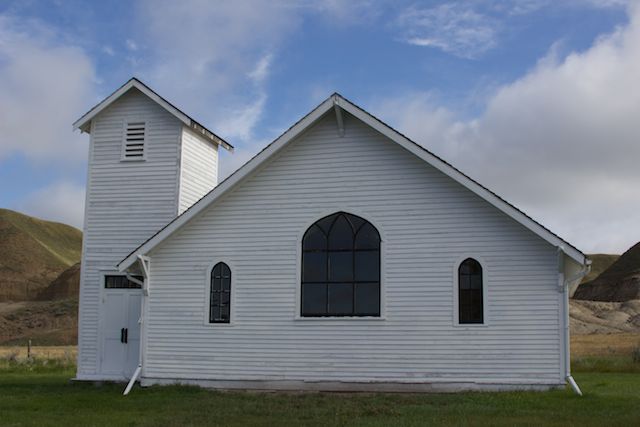
The lady who helped us at the visitor center was most kind and obviously proud of her town.  When we told her we weren’t much for tourist attractions, she showed us where we might find a beaver and a moose.  She circled the Hoodoos as a “must see” and suggested we visit two restored churches in Dorothy.  She cautioned us about driving in several areas because of clay roads being washed out or slick from the extensive rain they had been receiving.

Our campsite was quiet… in fact, we appeared to be the only ones there.  Our campsite overlooked a lovely sandstone painted skirt.


The next morning we drove out the famous Drumheller Hoodoo Park.  While small in stature, the community has certainly made the most of their Hoodoos, including elaborate stairs all around the sandstone structures.  The information plaques were very informative, and the hoodoos interesting.


We continued our drive up to Dorothy to visit their restored churches.  We decided to pass on the coal mining tour and dinosaur museum.


 It was late morning, so we continued driving, ending up in at Danielson Provincial Park near Gardner Dam.  While strolling, we spoke with one of the two other camping couples in the park.  They suggested a visit to Lost Mountain Lake to view migratory waterfowl and even let us borrow a book they had that included information about the lake.

The next morning, we stopped by Lost Mountain to take their driving tour.  The information center had warnings posted that the tour loop had several areas washed out due to the 2011 flood.  We took part of the tour, not finding many birds at all… most likely because we were in the middle of the day when most of these birds are out gleaning other fields.  We took a short hike up their grassland trail, but the wind was fierce and cold, sending us back to the truck early. 

Campgrounds in the area were few and far between, so we decided to travel onto the Quill Lakes, known for their abundant migratory waterfowl and the main reason we had taken this path through Saskatchewan.  Unfortunately, we chose to travel Highway 15 which was under major construction to make it into a heavy haul road.  The continued rain had turned an eight-mile section into the worst mud course we have run into… EVER!  The mud was easily up to the running boards in several places.  Thank heavens for four-wheel drive or we never would have made it through.  What a mess!  It took another trip to the car wash to clean the mud off the truck and camper so that we could remain fairly clean when getting in and out.


We drove into Wynnard and headed straight to their Waterfowl Interpretive Center.  While I hate to leave our dear friends hanging, what we learned there is worthy of a post all its own.  So we leave you in suspense…

Tuesday, September 15, 2015

Jasper and Sunshine!

Castle Rock near Banff, British Columbia
Perhaps it is because the mountains are such a draw for us that Jasper has become a favorite stopover when our travels head towards home.  We leave the Alaskan Highway in prairie but soon find the Rocky Mountains again in Jasper.  We checked the weather forecast on our arrival.  Sunshine is in the forecast, mountains are in view, and the elk are in rut.  Life is good!

It rained during our first night’s stay in Jasper, but the sun broke through as promised the next morning.  Not only that, but we awoke to find one of the bull elks pushing his harem right through our camp loop.  Wow!


We later found him wallowing in the creek.  Still later, we found him in another camp loop, bugling to his girls.  Although almost all of the photos had either site posts or campers in the background, it was great just to watch this magnificent animal and his harem.


Temperatures climbed into the 60s.  It was marvelous.  We sat and cooked outside… for the first time in weeks.  We watched the stars come out one by one each evening.  We took a drive up to Maligne Lake and took a hike.  


The following day, we  took a drive up to Pyramid Island, intending to take a hike.  Instead, we discovered a young couple getting married.  They walked just ahead of us, followed closely by their wedding photographer.  It was so special to witness the beginning of their life together.    


Instead of interrupting their ceremony, Roxanne took a dip with Pyramid Mountain in the background before we turned around and headed back to camp.


On our final day in Jasper, we took another hike in the morning, this time near the Green Lake area, enjoying the sunshine and watching others do the same.


That afternoon, we decided to explore parts of Jasper that we have ignored over the years.  We found a road leading to an unknown campground.  Past the Snaring River bridge, we discovered an unpaved road… our favorite kind!  This one, however, had posted times to travel in and posted times to travel out.  Perplexed about the notice and within the time limit to go in, we decided to take the drive.  It was great!


The first part of the road gave us no clue why the road had specific in and out times.  The second half of the drive, however, made it perfectly clear.  The road became more and more narrow as it hugged a mountainside.  We now understood the problem… between sharp switchbacks and blind corners, meeting another vehicle coming the opposite direction would have required one to back down (or up) several miles to allow the other vehicle to continue.  


As we began to gain altitude, the scenery was breathtaking.  We arrived at the end of the road, which was also the beginning of the Celestine trailhead, and waited for 3:30 to arrive so that we could head back down.


 That evening, we sat out and watched the clouds begin to gather. By morning, it was misty rain.  We decided it was time to move on, expecting sunshine in Banff per the forecast. 

We camped at Rampart Creek on the Icefield Parkway.  By evening, it began to mist.  By nightfall, rain drummed steadily on the roof of the camper.  When we awoke, we could see the line of snow not more than 500 feet above us.  

We broke camp and soon discovered that we were once again in a winter wonderland.  


The fresh snow slowed traffic enough that we were able to visit Athabasca Falls without too many other tourists.


Thankfully, the snow had not reached the Bow Valley Parkway, so we stopped to take one of our favorite hikes up the Rockbound Lake trail. 


When we arrived at the Tunnel Mountain campground in Banff, the snow began to fall in earnest in huge flakes.  The campground attendant assured us that it wouldn’t stick… she was wrong.  By morning, we were once again covered in a dusting of about two inches of snow.  Amazing!


After one more pass through the Bow Valley, we decided that it was time for us to continue our trek south.  We are headed to new territory this time… Saskatchewan.  What adventures await us there?

Monday, September 7, 2015

From Whitehorse to Muncho to Dawson Creek to Grand Prairie

Whitehorse has become our place for staging the Dempster and for cleaning up afterwards.  We arrived caked in mud.  It took $30 at a do-it-yourself car wash just to wash the majority of the mud from the undercarriage and running boards of the truck.  David wore his slicker suit but his face was so muddy after the car wash that he was hardly recognizable.

We had a shower at our favorite campground, the Caribou RV Park, followed by a wonderful dinner of jagerschnitzel and spaetzle at the Wolf's Den restaurant.  The next morning, we had many errands to run, including changing the oil in the truck, reprovisioning, and doing laundry.  By the time we were done, Whitehorse had become amazingly busy in preparation for their Labor Day holiday.  It is always a surprise to come back into civilization after the remoteness of the Dempster.

While we rarely eat out during our travels, we call this section of the Alaska Highway between Whitehorse and Tetsa our "foodie" section.  We have dinner at the Wolf's Den in Whitehorse, stop at the Rancheria Lodge for breakfast, have schnitzel again at the Northern Rocky Mountain Lodge, then top it all off the following road day with one of the best cinnamon buns on the planet at the Tetsa Lodge.  (We have learned over the years that we can only have one cinnamon bun and split it... the results of the sugar low after eating a whole one each is not a pretty sight!)

Our good weather coming off the Dempster didn't last.  It rained overnight in Whitehorse.  From there on, we couldn't seem to outrun the weather as rain continued to chase us.

We saw wood bison and both black and grizzly bear along the northern section of the Alaska Highway before Muncho.


While in Muncho Lake, we took a hike up Mineral Lick Trail in between showers.


I finally relented and let Roxanne in the lake for a swim.  She was so happy but spent most of the afternoon shivering until I finally had her mostly dry by using nearly every remaining towel we had.


We found a few animals during our morning tours between the hiking trail and Toad River, mostly stone sheep.


Our last afternoon in Muncho and after our hike, we discovered an Xterra and trailer precariously pulled off alongside the Alaska Highway with Katie sitting inside.  Katie told us that the truck had just quit running.  Husband Kevin had caught a lift to the lodge to call the Canadian version of AAA.  We found Kevin and gave him a lift back to Katie.  Kevin told us they were on their way to Prince Rupert so that Katie could finish nursing school.  The tow truck would be by in two hours or so to tow them into Fort Nelson.  It was a holiday weekend, however, and Kevin feared they would not be able to repair the truck until Tuesday.  Normally these trips of ours have been all about the animals.  It has been interesting to see the many human paths we have crossed during this trip.

After two rainy nights in Muncho, we decided to try to finish the Alaska Highway at Dawson Creek.  As we drove south, we found breaks in the clouds and spectacular fall scenery.


The southbound drive between Muncho Lake and Dawson Creek is always bittersweet for us.  At Muncho, we are in the northern end of the Rocky Mountains.  By Fort Nelson, the mountains have turned to hills, then to pastureland, then to prairie by Dawson Creek.  It is sad because we know that the remoteness, unpaved roads, and multitude of wildlife are behind us.    

Dawson Creek has always been our drying out camp.  Each time we have arrived, it has been sunny and warm.  We drag all our wet gear out to dry, looking much like a Hungarian tent city with all the towels and bedding.  Not this trip.  The rain again caught up with us.

We awoke to a downpour and headed to Grand Prairie, realizing that we were keeping pace with a front that was heading east.  After stopping at a laundromat to dry the towels, we decided that in order to get past the rain we would need to pull up somewhere.  We checked the map, and Jasper looked like the next good spot.  Hopefully in Jasper we will find sunshine and elk!

Thursday, September 3, 2015

Traveling the Dempster Highway - Part Two

Tombstone Valley
We awoke to more rain.  With temperatures, however, hovering in the mid-30s, we were delighted that it wasn’t snow.  We broke camp and headed toward the ferry crossings, not knowing what to expect.

The Mackinsie River crossing, the widest of the two crossings (by four to five times), was the most rocky that we had ever encountered.  We shared the ride with an 18-wheeler and five other vehicles.  The river was the highest we had ever seen it with rough waves and swift current.  The ferry rocked heavily as we crossed. 

When we arrived at the Peel River cable ferry crossing, we were delighted to find it in operation.  David asked the operator what had happened when the cable broke.  The gentleman told us that it was the Mackinsie ferry that had broken.  A cable supporting the landing ramp had snapped but was easily repaired.  The Peel ferry crossing was high but easy enough.

Peel River Ferry before landing washed out.
From the Peel River ferry, we approached the Northwest Territory border with the mountains becoming ever closer.  We were amazed to see the amount of snow that had accumulated over the past several days.  Instead of taking photos of fall colors, we were treated to a winter wonderland.  


 We spied an enormous grizzly bear near the border, but he was too far away to take good photos.


The pass was sloshy but passable, so we traveled back down to Rock River campground.  Only two other men shared the campground with us.  They were bicyclers from Quebec who were on their way north to Inuvik.  The men had set up in the campground’s shelter. Again the temperature hovered near freezing.  We hoped they had sufficient gear to stay warm.  They said that they did, so we set up our camp quickly, turned the furnace on, and crawled into the camper for an early night.


David woke me with his usual good news/bad news scenario.  This time the good news was that it had stopped raining.  The bad news, however, was that the rain had turned to snow… about four inches worth.  On exiting the camper, however, we quickly discovered that we had a much greater problem.  The heavy snow had so burdened the trees surrounding our site that many had fallen directly in the path of the truck.  We were completely snowed in!

The truck... buried behind all the snow-laden trees
For the next hour or so, we worked to clear the truck.  We shook the smaller trees to help them right themselves.  This Texan quickly learned a valuable lesson during this experience… never stand underneath a tree when you try to shake the snow off of it!  Burr… a bath of snow down my neck that early in the morning was not my idea of fun!  We also had to tie up several trees to pull them out of the way.  Soon, however, we were able to drive the truck out from the site.

Escape from Rock River

We checked with the bicyclers as we left the campground.  One was optimistic, the other looked dismal.  In broken English, he said that he had tried the road and it was too muddy and snowy to travel.  On top of that, they only had two day’s ration of food.  We offered to take them south, back to Eagle Plains.  They refused, saying that they had airplane reservations out of Inuvik in ten days.  We gave them food.  They gave us their names so that we could have the people at Eagle Plains make certain they were successful in making their flights.  It was difficult to leave them.  As we drove away, we saw only the faces of two forlorn-looking bicyclers watching their only means of escape traveling south down the highway.

The road was completely snowy as we left the campground.  It felt like we were the only people on earth.  Finally we saw a maintenance vehicle and flagged them down, telling them about the bicyclers, hoping that they would take them to Fort McPherson or on to Inuvik. 

Dempster's snowy road
As we traveled, we saw a pair of fox dashing ahead of us on the road.  We spied several sandhill cranes looking quite lost in the deep snow. Ptarmagin also greeted us... their feet and underbellies beginning to turn white.


We crossed the Arctic Circle, finding it covered in snow.  We had to stop to take a photo!


A few miles up, we stopped in Eagle Plains and spoke with a lady at the desk about the plight of the two bicyclers.  She gave a wry smile and said that she had warned them not to go and had already sent someone to retrieve them.  What a relief!

We decided to top off the tank with gas.  The mechanic said that he had never seen the Dempster so rough in his entire time at Eagle Plains.  Another gentleman told us that they had closed both ferry crossings, and he had been one of the last ones to cross safely.  They had closed the Mackinsie River because the water was too rough.  At the Peel crossing, the river had crested so high that it washed away the landings on both sides, essentially stopping all traffic north and south of Fort McPherson.  Crews were now rebuilding the landing on higher ground but it would take several days to complete the project.  We felt so fortunate that we had left early or we, too, would have been stranded.

As we passed the German van that had rolled, I asked David to turn into the pullout so that I could get a photo.  To our surprise, there was something black and fuzzy moving in the back of the van.  David and I both burst out laughing when a black bear poked his head out the back window.  Evidently the Germans had only taken their essentials, leaving food and other items behind.  Bears… ever the opportunists!  He was literally ripping the guts out of the van.  We could hear him tearing carpet as he looked for any food item he could find.  What little there might have been to salvage after the wreck had now been destroyed.


The further we drove along Olgivie Ridge, the deeper the mud.  Tire tracks were so deep in some places that we could feel the mud push against the underbelly of the truck as we slogged and slid along.  Thankfully, we met few vehicles along the way… and thank goodness for four wheel drive!  By the time we were off the ridge, the snow had turned back to rain.    

We boondocked again at our little high spot near Engineer Creek and waited for morning.  The clouds were higher, but it was still misty rain mixed with snow.  We headed straight for the Tombstone Visitors Center to check the forecast.  With a promise of clearing on Wednesday, we decided to wait the rain out another day in hopes of fall color photos of the amazing Tombstone Valley.


We camped at Tombstone... yet another cold night.  We had now been in freezing rain and snow for a solid week.  Temperatures had hovered between 28 and 35 degrees.  I know that our Colorado friends will laugh at us, but we were truly miserable.  Our walks had been reduced to making certain Roxanne’s business was done.  Every other moment, we spent in the truck or camper.  Even our winter parkas didn’t seem to ward off the chill. 

The next morning brought more clouds and snow flurries.  We tried to be positive, hoping that the skies would, in fact, clear towards noon as the forecast promised.  Regardless, we planned to leave the Dempster by one that afternoon in search of warmer weather. 

To pass the morning, we took a drive back up to Two Moose Lake for one last hunt for moose.  We have been by this lake nearly a dozen times on our trips up the Dempster.  Not once have we seen a moose.  The worst part about it is that it seems that everyone else has.  One lady this trip even told us that she had seen 21 moose in one evening!  We sat at the lake and had breakfast, searching the horizon for signs of moose.  There were none to be had, although we did see a patch of blue sky overhead.  Hoping that it meant clearing in Tombstone, we decided to leave.  As we drove off, we noticed something moving quickly across the tundra some several hundred yards off the road.  It was a moose cow!  Finally, the spell had been broken.


We parked at the pullout overlooking Tombstone Valley.  The sun broke through the clouds every so often, and I would don my parka and take a few photos.  By two, it began to cloud up again.  Sadly, David and I determined it was time to bid farewell to my beloved Dempster Highway.  It is always an amazing adventure driving this road… and this time certainly did not disappoint!


As we dropped some 2,000 feet in altitude, the temperatures began to rise.  By the time we reached the beginning of the Dempster, it was 52 degrees and sunny.  Clouds still covered Tombstone, but we were shedding layers of clothes, happy to find warmth and sunshine again.  We drove into Dawson City to tank up with gas, then headed on towards Whitehorse.  Our trip south had finally begun.