Tuesday, June 6, 2017

Looking for Sunshine in Petersburg

Petersburg on Mitcoff Island, Alaska
When we booked our ferry schedule several months in advance, we were looking specifically for islands with little or no cruise ship traffic.  Early in our retirement, we had driven into Skagway and were aghast to find this little town with a population of about 800 swollen to over 30,000 people from five or six cruise ships.  After being remote for so long, there was just too much hustle and bustle for us.  While we recognize that cruise ships have much to offer, with my claustrophobia I long to stay clear of crowds.

We had read that the ports of Wrangell and Petersburg had little to no cruise ship traffic.  If cruise boats stopped at these ports, they were only the smallest of ships.  The large cruise ships simply could not reconnoiter the Wrangell Narrows, a sliver of a channel with islands on either side.  Our ferry, the Matanuska, was the second largest ferry that could pass freely through this area.

As we sailed the Narrows, we were astonished at how close the navigational buoys were to the sides of the ferry.  Truly these were a navigational nightmare... hopefully these photos will help you understand how narrow these Narrows are!

A view from the rear of the Matanuska as it reconnoiters the Wrangell Narrows

The ferry had to steer between the right and left buoys in the Wrangell Narrows

More buoys to steer through on the Wrangell Narrows
We arrived in Petersburg under heavy clouds.  Occasionally, a patch of blue would peak through.  The tiny specks of blue passed within moments, however, and were quickly engulfed again in gray.  After days of rain on Wrangell, we were beginning to say just what the locals said... when folks called this a temperate rain forest... well, they mean just that... RAIN!


Liz and Walter met us at the Petersburg visitor’s center.  The young lady at the desk was remarkable… able to answer questions from four people with four different perspectives, and all firing in rapid succession.  We each needed re-provisioning, so went our separate ways with plans to meet at Green campground toward the southern end of the island.

We quickly became entranced by Mitcoff Island and the lovely town of Petersburg (known as "Little Norway").  We were delighted with Green campground.  It sat right on the bay, overlooking mountains.  Our site was literally 15 feet from the point of highest tide.  The clouds parted a bit and the mist stopped.  Walter and David stoked a fire while Liz and I prepared supper. 


View from Green Campground, Mitcoff Island
Green's Campground on Mitcoff Island
Rain began in earnest that night and followed us throughout next day.  We visited the museum and watched a very interesting movie about Mitcoff Island, including the founding of Petersburg, its Scandinavian roots, and how it has grown into the working town it is today. 

Later, David and I discovered Tonka Seafood on the outskirts of town.  A young lady sold us a filet of fresh-frozen silver salmon for $8.25 a pound… a bargain as far as we were concerned.  It was great to be able to share the bounty of Alaska’s seas with Liz and Walter.

Sunset hidden by clouds on Mitcoff Island
Fearing that we would never get to see the island if we waited for the rain to stop, the next day we donned slicker suits and took a hike.  That afternoon, we stopped by the library to check emails, only to find that one of our credit cards had been compromised.  Thankfully, the fraud department had recognized that the charges were not ours.  They would send a new card to our final port of call.

Hiking in the rain on Mitcoff Island
Our last day in Petersburg, the sun broke through the clouds, and we had a glorious day.  The lupines along the roadside were absolutely stunning in the brilliant sunshine.

Lupines on Mitcoff Island
Lupines along the roadside on Mitcoff Island
The four of us took several hikes together, around Man Made Lake, then over to Crane Lake and Hill Lake.  When we reached the last two lakes, we discovered rowboats and landings available for hikers to use to paddle around the beautiful shorelines. 

Man Made Lake, Mitcoff Island 
Hill Lake, Mitcoff Island
As we traveled the gravel road back to town, we startled a black bear… Liz and Walter’s first.  Further up, an enormous porcupine scurried across the road.  As they slowed down next to us, Liz rolled down her window and asked, “What the heck was that?”

That evening, we were in line for the ferry by 9:00, ready for the eight-hour sail to Juneau.  Learning from our last overnight cruise, we had booked a cabin.  The cabin on the Matanuska was much smaller than the cabins on the Canadian ferry.  The shower, however, was more than welcomed, and I was ever so glad to have a window near the bunks to make the cabin feel larger.


The purser knocked on our door around 6:30 the following morning, announcing our arrival in Juneau. We were leery about the cruise ship traffic but ready to see what Alaska’s capital city had to offer.  We looked out the window to discover SUNSHINE! 

Our time with Liz and Walter would come to an end in Juneau.  After two days and nights, Liz and Walter would leave for Sitka.  David and I would leave the following morning for Haines.  We felt blessed that our time together would end under glorious, clear skies.

Walter and Liz on Mitcoff Island

Saturday, June 3, 2017

Rain on Wrangell Island

Wrangell, Alaska
Heavy skies greeted us in Wrangell after our six-hour sail from Ketchikan.  By the time we arrived, it began to mist.  Still, we were delighted to be here.  Wrangell seemed like our kind of place… a small, working harbor town.

We had again met our new Australian friends, Liz and Walter, at the ferry landing before boarding.  During the sail, we decided we should camp near one another.  When we landed, they went one direction, and we the other.  Surprisingly, we ended up traveling to the exact same campsite. 

The following morning, we headed to town, looking to fill water tanks.  Folks at the Visitor’s Center were kind enough to allow us to hook up our respective hoses to their spigouts.  While there, we also discovered that Wrangell had ancient petroglyphs on the beach on the northern end of town.  The four of us determined to meet there at low tide.

Petroglyph Beach State Historic Park is located near the ferry terminal.  At low tide, over forty petroglyphs are supposed to be visible.  We climbed all over the rocks, scouring each rock face for ancient art.  We only found a half dozen, and most of those were barely visible.  Nonetheless, it felt like a treasure hunt.

Ancient petroglyphs on Wrangell Island
Petroglyphs on Wrangell Island, dated to be over 12,500 years old
While walking along the beach, we met another Australian couple, Trish and Will.  It was a reminder what a small world this is… they actually lived in the same town as Liz and Walter.  Trish and Will had purchased an old sailboat and were cruising the coast from Vancouver Island up to Juneau.

For our evening meal, I offered to fix fajitas… something Liz and Walter had never tried before.  Now… if I could only find tortillas on the north coast of Alaska!  Thankfully, the Coastal Market was quite well stocked for such a small store… we even found fresh hot salsa and guacamole.

We returned to Nemo State Park and found the premiere Highline campsite empty.  This site had stunning views of the bay.  We quickly found our friends and asked if they would like to move to the new site.  While Walter and David built a fire, Liz and I sliced vegetables for the fajitas.  Thankfully, the rain held off during our meal.  Soon after eating, however, the rain began again.  We dove into Liz and Walter’s camper for an evening of rousing conversation.  What fun! 

Liz (third from left), Walter (far left), and us at Highline Camp in Nemo State Park, Wrangell, Alaska
Rain followed us the next day.  David and I found showers at the local laundromat and tried to find fresh fish for an evening meal.  It is amazing to me how few towns in Alaska sell fresh fish!  Later that afternoon, we were able to take a short hike on the Volunteer Park Trail, an interpretive hike through a muskeg forest.  Muskeg is the name for a bog or a swamp covered in sphagnum moss and peat.

Our last day on Wrangell, the rain continued.  We visited the very informative Nolan Center museum in the morning, the city park and its totem poles, and spent the afternoon in the library, avoiding pelting rain and trying to catch up on blog posts.  Trish came into the library and invited the four of us over to their boat, Shadowdancer, for “grog.”  We had to ask Liz and Walter what it meant… Auzzie for a drink.  

Totem poles, downtown park, Wrangell, Alaska

Totem poles, downtown park, Wrangell, Alaska
The rain slowed to a drizzle while we visited Trish and Will.  We had such a great time, getting to know each other and seeing how Trish and Will camp out on their boat.  During our stay, the harbor master stopped by to introduce himself.  We told him how grateful we were that Wrangell didn't host any of the large cruise ships.  He told us that in order to do so the town would have to "sell out."  At each port the cruise ships enter, they buy up buildings to sell their souvenirs and run their adventure tours, leaving few of the profits for the community.  The rain began again, so we bid Trish and Will goodbye and safe travels and returned to our campsite.

The next morning, we boarded the Matanuska ferry again for a three-hour day sail, leaving at 10:15 under misty rain.  We searched the skies for signs of blue but found none.  Surely the weather would break in Petersburg!

Tuesday, May 30, 2017

On to Ketchikan

Ketchikan Harbor
We left Haida Gwaii at ten o’clock in the evening.  As the ferry left dock, we were delighted to have hot showers and a berth for the night.  We arrived in Prince Rupert at seven the following morning.  The only restaurant we could find for breakfast opened at nine, and the visitor’s center didn’t open until ten.  So we strolled Cow Bay, enjoying the sunshine. 

After a great breakfast at Prince Rupert’s local institution, the Smile’s Café, we took a 3-1/2-mile hike around the Butze Rapids interpretive trail to see its reversing tidal rapids.  Then we visited the quite informative and well-worth seeing Museum of Northern BC.  Having exhausted what we could do in a single day, we arrived at the ferry nearly three hours prior to departure.  We again met the Australian couple we had seen on the ferries since Vancouver Island.  This time we sat and shared stories while waiting.  It felt like a friendship was beginning.

Butze Rapids' reversing tidal rapids near Prince Rupert
Our ferry to Ketchikan left at 7:45 pm and was scheduled to arrive at 1:45 the following morning.  We decided to forego a cabin and simply snooze in the lounge area… our mistake.  We should have booked a cabin… lesson learned.

We sailed on the Alaska marine ferry Matenuska, an old and worn ferry in comparison to Canada’s Northern Adventure.  By the end of the evening, we decided that the lounge chairs must have been designed by a masochist… they were much like seats on an airplane only with more legroom and much less padding.  It was impossible to find a comfortable position. 

Bleary-eyed and exhausted, we arrived in Ketchikan around two in the morning and, along with a half-dozen other rigs, drove straight to the Walmart parking lot to spend the remainder of night. 

Bright and early, seaplanes taking off woke us up, but the sunshine certainly brightened our day.  We headed downtown to the visitor’s center, found a parking spot, and walked to the visitor’s booth.  

Downtown Ketchikan was already buzzing with two cruise ships in port.  As we walked toward the visitor’s booth, the Disney Wonder cruise ship docked.  Soon the boat was alive with people, boiling out of its decks and onto the docks like the end of a college football game.  The streets of Ketchikan began to overflow.  Hawkers peddled their wares.  Tour buses thundered and belched their way through town.  Ducks (amphibious vehicles), filled with tourists, rumbled towards the harbor.  Seaplanes soared overhead, taking tourists to the fjords and other sights.  It was simply too much after being ten days on a small, remote island.  We also discovered that we had arrived in Ketchikan on Memorial Day weekend, which only added to the chaos. 

Ketchikan's cruise ship harbor
We ducked into bookstore to find more reading material.  Shortly after we arrived, the Australian couple, Liz and Walter, walked through the door.  We laughed and told them that we were spending too much time together.

Our new Auzzie friends were having refrigerator problems with their rented rig, so they had opted for the last remaining spot at the RV park.  We left them and drove to Totem Bight, a wonderful state park that displayed a variety of replicated totem poles.

Toten Bight State Park, Ketchikan

Toten Bight State Park, Ketchikan
Afterward, we drove to the campground on lovely Ward Lake, figuring we needed to find a camp spot early because of the holiday.  It was already full.  We drove to Settler’s Cove at the end of the island.  It was also full, but we took a lovely hike there.  Then we drove up Brown Mountain, expecting to find a pull out or some secluded road for a camp.  We found none.  Ultimately, we found a pullout on the lake road and spent the night there.

We spent much of the following morning trying to find potable water.  The visitor’s center was no help.  A ranger suggested the dump station next to the water department.  They had water, but it wasn’t potable.  Go figure!  We called the only campground, but they were full and unwilling for us to fill up with them.  Ultimately, we bought five gallons of drinking water at Walmart.  Obviously, Ketchikan is set up for cruise ships… not campers.

To our surprise during another drive into Ward Lake campground, we noticed several campsites open.  Of course, we immediately grabbed one and set up camp.  That night, we discovered why so many spots were available… several nearby campsites were filled with large groups of folks who were extremely loud and had no problems chopping wood at two in the morning.  These folks were so loud that someone must have complained.  Law enforcement came to chat with them the following day.

Monday we drove into Ketchikan early, hoping to avoid the deluge of cruise ship travelers.  We visited several small museums and walked along Ketchikan’s infamous Creek Street.  The street is well known for its history of brothels and speak easies but is now a destination for souvenir shoppers.

Ketchikan's infamous Creek Street
When the crowds began to grow, we headed north.  Now that the holiday weekend was over, the campground was empty, except for a few campers also bound for tomorrow’s ferry.  We strolled along the lake, drinking in the sunshine and quiet.

We left Ketchikan Tuesday morning on the 11:45 am ferry.  I admit that we were very happy to do so, particularly with two more cruise ships scheduled to arrive later that day, each bringing another 5,000 visitors.  Under fair skies, we set our sights for Wrangell Island, hoping for a bit of serenity.


Friday, May 26, 2017

About Haida Gwaii

Haida Gwaii Eagle
Because of ferry scheduling issues, we had a choice to spend four or ten days on Haida Gwaii.  We chose ten.  We have certainly found beauty and wildlife here.  We have, however, also found an island in recovery.  We expected to kayak along tidal pools brimming with sea life.  We also expected to hike among old growth forests.  They do not exist on Haida Gwaii... or if they do, we certainly could not find them.

As I mentioned in our first Haida Gwaii post, the fur trade took a tremendous toll on these islands.  It decimated sea lions to less than ten percent of their breeding population and exterminated sea otters from these waters   Unsustainable logging stripped the mountainsides.  Today the Haida Gwaii people work in concert with the Canadian government to protect these animals and islands.

While logging is still a major industry on Haida Gwaii, it is carefully monitored.  In many places we saw tall white pillars amid clear cut logging areas.  Inside each of the pillars was a tiny cedar seedling.

Cedar seedlings protected on Haida Gwaii
Cedar seedlings amid clear cut logging area on Haida Gwaii
Cedar seedling grows on Haida Gwaii
Ecosystems have been ravaged with the elimination of some animals and the introduction of others.  As an example, without sea otters keeping the kelp-eating sea urchin populations in check, sea kelp forests are now underwater deserts, eliminating habitat for sea stars and other marine life.  Additionally, land ecosystems have been radically altered with the introduction of several destructive species, including the Sitka black-tailed deer, raccoons, red squirrels, and rats.  

Deer were introduced for human consumption but because they have no predators, their numbers continue to increase.  Adding to the issue, deer can swim and now inhabit every island in Gwaii Haanas.  The deer strip the forest floors and change plant ecosystems. 

Pelt traders introduced raccoons for fur.  Foresters introduced red squirrels to collect spruce seeds from their cone caches.  Rats were accidentally introduced.  All three species eat songbird eggs and have vastly reduced their population.  These stories are stark reminders of the vulnerability of delicate natural balances.

We have also pieced together the history of the Haida Gwaii peoples.  Their cultural museum in Skidegate spoke about their artwork, their mythology, how they see themselves as part of their natural world, and how they are working to reclaim their land.  Surprisingly, it did not speak about their culture, including wars, religion, and burial practices. 

The Prince Rupert museum seemed to present a more balanced history of the northern coastal tribes than many of the other museums we visited.  As a result, we were able to piece together some of the missing components. 

The Tlingit, Haida Gwaii, and other tribes of the northwest coast were in intense competition with each other for political and economic dominance, often escalating into war.  They took slaves and burned the villages they conquered.  They were a very hierarchal society, with a class system determined by status and wealth.  Their religion was animism.  We learned that the Haida Gwaii burial practices were to take their dead into caves or special areas, leaving the animals to render carcasses to bones.  About a year later, the bones of prominent people were buried in bentwood boxes atop memorial poles.  Commoners had much less elaborate burials.  The Prince Rupert museum indicated that the bodies of slaves were often mutilated. 

Because of their focus on wealth and political dominance, tribes saw European fur traders as an opportunity to increase their status.  We read a timeline that included Haida Gwaii traders delivering over 1,800 otter pelts to the Russians.  In forty years (1770 to 1820), sea otters were hunted to extinction.

Between 1890 and 1920, a radical shift came to the coastal tribes. Colonization brought disease, education, and a monetary economy.  Diseases such as influenza and small pox took a terrible toll on native populations.  Children were often sent to government schools where they were forbidden to speak their native tongue.  Rather than dependence on the land, the peoples of the northwest coast tribes relocated to towns for stationary livelihoods.  Traditional ways of living and identities were on the verge of being lost. 


Today there is a cultural resurgence within the Haida Gwaii and other northwest coast tribes.  Once again their potlaches, songs, and dances are being passed down.  They teach their children to speak their native tongue.  They work to repatriate their dead from museums around the world. There is now cooperation between governments and the native tribes to protect the lands and revitalize ecosystems.  Their cultural artwork flourishes, along with their inherent stories and identity.  We wish them and their islands our best.

Thursday, May 25, 2017

Haida Gwaii, Part Two

Rennel Sound, Graham Island, Haida Gwaii
The beautiful weather that greeted us when we arrived on Haida Gwaii dissolved into six straight days of rain, with only a few sporadic lulls in the deluge each day.

While waiting for the ferry back to Skidegate, the fellow in front of us suggested we go to Rennel Sound on the west side of the island and even told us his best camp site.  He also cautioned us about logging traffic.

We stopped at the Forest Service office to ask for advice.  They suggested we park along the entrance to the road, wait for a logging truck, and follow them up the road.  About fifteen minutes into our wait, a logging truck pulled up beside us and parked.  The fellow walked over to us and asked if we were headed to the Sound.  He suggested that we go ahead of him so he "wouldn't dust us" and that he would call ahead to let others know that we were on our way.  His generous offer certainly made the drive feel much less perilous!

Rennel Sound is on the Pacific side of Graham Island.  We set up camp in misty rain.  Thankfully by evening there was a break in the clouds, and we were able to see a lovely sunset.


Rennel Sound at sunset
A family of eagles with two fledglings fished near us.  Later, folks in our neighboring campsite gutted their freshly-caught fish and tossed the entrails along the beach.  The young eagles were quick to swoop down for a meal.


The next day we hiked to Bonanza and Gregory Beaches.  Each hike led us through dense forests of Sitka Spruce, cedars, and hemlock.  Moss clung to the trees, rocks... everything.  As one local lady told us, "If you stand still too long here, moss will grow on your legs."

Bonanza Beach
Gregory Beach
From Rennel Sound, we drove to the northern tip of the island and camped at Agate Beach.  Whenever the tide was out and the rain slowed, local folks combed the beaches for the agates that washed ashore.  One lady was kind enough to show us what kind of rock to look for.  We ended up with several translucent rocks that seemed to fit her description.

The rain continued.  One night the wind buffeted the camper while rain pelted the top so hard that it sounded like a dozen or more elves were pounding the roof with little hammers.  We finally gave up waiting for the weather to break the next day and, instead, did laundry.  Of course, during the first wash cycle, the rain quit until all the clothes were dry.  Then the rain began again.

We visited a great little museum in Masset, home to most of the European settlers.  The neighboring town, known as Old Masset, is home to many of the indigenous families.  Their streets were lined with totem poles.  

Totem pole in Old Masset
An outcropping of rock named Tow Hill rests on the end of Agate Beach.  We tried for three days to climb it.  Most of the time great clouds circled the top.  Our last day, we finally had a bit of a break in the rain and decided to take a chance.  The hike is short... barely 1.5 miles round trip... but it quickly gains over 450 feet in elevation.  The entire trail built with boardwalks and over 200 stairs.  

Tow Hill trail
With so much rain, we noticed as we hiked through the forest that every dimple or depression in the ground caused puddling and the puddles turned into little streams, then into small creeks.  Water dripped from the trees and shrubs and squished under our feet.  By the time we reached the top, we were in misty rain again.  We did, however, manage to take a photo...

Looking up to Tow Hill, Graham Island

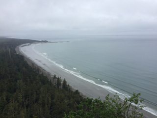
From the top of Tow Hill, Graham Island, looking towards Rose Spit
We left Masset the next morning, camping at the Misty Meadows campground.  After another night of rain, we awoke to clearing skies.  What a welcomed sight!  Unfortunately the wind was far to heavy for us to rent kayaks. Instead we visited the Port Clements museum and drove back to Queen Charlotte.

Haida Gwaii museum entrance
Our last day on the island, we visited the Haida Gwaii museum, took a hike up Spirit Trail, and basked in the sunlight.  Before catching the evening ferry back to Prince Rupert, we sat along the shoreline and watched whales spout near Tree Island.  Our spirits were buoyed by the sunshine.  Our next ferry stop will be Prince Rupert, then on to Ketchikan.  Hopefully the sun will lead us.